But before we get to that...
drummroll da da da, da da da, daaaaa!
Full house on Cardinal Point Bingo!*
Hurrah!
Yes our road to John O'Groats took us along the north coast,
past more deep lochs
and stunning beaches,
across the wild deserted moors
with high peaks in the distance
and finally through the much tamer, gently rolling farmland of the North East Highlands
and right past Dunnet Head, the northernmost point of mainland Britain.


A sheer cliff promentory with a view to the Orkney's - somewhere else on Brian and Ulla's recommended list which we will have to come back to - and in a full circle, past John O'Groats to the east on the one hand, all the way west to Cape Wrath on the other and due south to the rest of the country dead ahead.
So here's to the end of that quest, just the big one left as the clouds start gathering on the horizon... Race to the finish then!
John O'Groats is a bit like Land's End but with slightly less tat (no shopping mall or tacky arcade at least) and sadly slightly less impressive scenery.

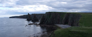
At Land's End, you do at least get a feeling that you're at the end of the world and there is nothing beyond - once you turn your back on the tat anyway. At John O'Groats it just sort of stops. And then there are the Orkney's, resplendent on the near horizon, seemingly just within touching distance. And they take the iconic sign board down at the end of the working day! But to be fair, we weren't there for very long, just time for a couple of photos and a postcard to adorn the wardrobe next to our Land's End one, before we headed to nearby Duncansby Head with its lighthouse, cliffs and impressive stacks. This is more like it!

So here we are. Parked up with a view over the gentle hills down to John O'Groats. Official end of the trip!
Curiously, if you go to Land's End, it is 874 miles to John O'Groats but if you're going from John O'Groats it is 876 miles to Land's End. I bet those two miles make all the difference if you're on a push bike! I wonder if that's why most people go south to north and not north to south... :) still, we clicked over 20,000 trip miles today on our journey between the two so there you go. It's nice to have such a lovely round number to finish on!
Despite that though, it feels all a bit sudden really. I honestly didn't expect when I woke up this morning that I would finish the day here! It feels like it should be more momentous somehow.
But we have cheap and cheerful bubbly fizz to celebrate - Lidl Cava, their champagne being unexpectedly too expensive for van dwellers! - one glass of which is already making me feel a bit giddy - I am such a cheap date these days! -


my final daisy is painted - bit of a hiatus in daisy painting as I ran out of paint in Finland and it was €18(!!) a can in Norway... -
and the sun is setting on John O'Groats and our adventure in a splendid display of glorious colour.
The perfect end to a perfect day and an even more perfect trip.
Cheers!
*giggle*
* For the cardinal points fact fans amongst you:
Extreme Points of Mainland Great Britain
Northernmost point – Dunnet Head at 58°40′N 3°22′W
Southernmost point – Lizard Point, Cornwall, England at 49°57′N 5°12′W
Westernmost point – Corrachadh Mòr, Highland at 56°42′N 6°13′W **
Easternmost point – Lowestoft Ness, Suffolk at 52°28.87′N 1°45.77′E
**Corrachadh Mòr (56°42′56.20328″N 6°13′40.59731″W) is a small hillock on the Ardnamurchan peninsula in Lochaber, Highland, Scotland, notable for adjoining the most westerly point on the island of Great Britain. It is about 36 kilometres (22 miles) further west than Land's End in Cornwall.
Depending on which coordinates are used, this headland is 30.78 metres or 42.81 metres west of Ardnamurchan Point (about a kilometre to the north). The latter is commonly, but incorrectly, described as being the most westerly point on the peninsula.


No comments:
Post a Comment